There's something starkly beautiful about this map. The whole length of the river, diagonally cutting across the map, the lack of any features other than those directly along the water, the blankness of the remainder of the map. It's quite stunning, really.
The map also appeals to me because it features some places I know well, but in a way I've never seen before. They are almost presented without context. Yes there is latitude and longitude, but if you had never heard of the river, or the cities on it, you would have no idea where in the world it was.
Below, I've posted images of some of my favorite features of the map. First though, I did some research on the Duke of Orleans, who commissioned the map off of which this map was based. In 1780, he was a man named Louis Philippe d'Orléans known as le Gros (the Fat). It seems he was a military man, but also, in his later years, a patron of the arts and sciences. Wikipedia lists a number of well known artists and scientists he was close with. Cartographers don't feature in this list, but it would seem reasonable that such a man would have an interest in such things. It would be interesting to hear from someone with more knowledge of this man, or of this map, why the St. Lawrence river, in particular was commissioned.
I also looked up the original map maker. D'anville. It seems that what distinguishes him so much from his contemporaries, is his willingness to leave blank spaces he knew little or less about. This seems to be the case here, but the result is fascinating and magnificent.
Scroll down for some more close-ups of this latest addition to my map wishlist.
 |
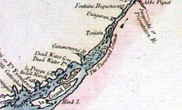
| The beautiful "Thousand Islands" region in Ontario, on the Canada-U.S. border. |
 |
| A somewhat distorted view of Montreal. Note St. Anne, on the Island of Montreal. Today a beautiful suburb of the city. |
 |
| Quebec City, and the mouth of the river. Interesting here is the great detail of smaller tributaries of the river. |

No comments:
Post a Comment